Update - 8 a.m. advisory:
The National Weather Service forecasts strong winds and storms surge along the coast of the Florida Panhandle Saturday as Tropical Storm Nestor continues its approach toward the U.S. mainland.
The tropical storm is expected to "move inland over the Florida Panhandle late this morning or early afternoon." A storm surge warning remains in effect for Indian Pass to Clearwater Beach. As many as 2 to 4 inches are likely to fall in northern Florida, which could lead to flooding.
Tropical Storm Nestor updates: Storm center redevelops farther west
Tropical Storm Nestor track
Follow Nestor's path as it nears the Florida coast by clicking here.
Tropical Storm Nestor officially forms Friday
Tropical Storm Nestor officially formed Friday afternoon and is on Tallahassee's doorstep Saturday morning.
The storm could bring winds around 40 mph, 2-4 inches of rain and localized power outages to Tallahassee, but widespread damage isn't expected. As of Saturday morning, the entire Big Bend, including Leon and surrounding counties, and the Panhandle are under a tropical storm warning.
Live webcams:See Tropical Storm arrive at the coast
As of 4 a.m. Saturday, the National Hurricane Center places the elongated center of Nestor around 75 miles southwest of Apalachicola and is moving northeast at 17 mph.
“Nestor is rapidly losing the few tropical characteristics that it once had,” said NHC Senior Hurricane Specialist Lixion Avila in the 4 a.m. storm discussion. “The cloud pattern consists of a large circulation of low clouds with a comma-shape convective band well to the east of the circulation. This band is already over a large portion of the Florida peninsula.”
Storm surge and tornado watch for portions of Florida
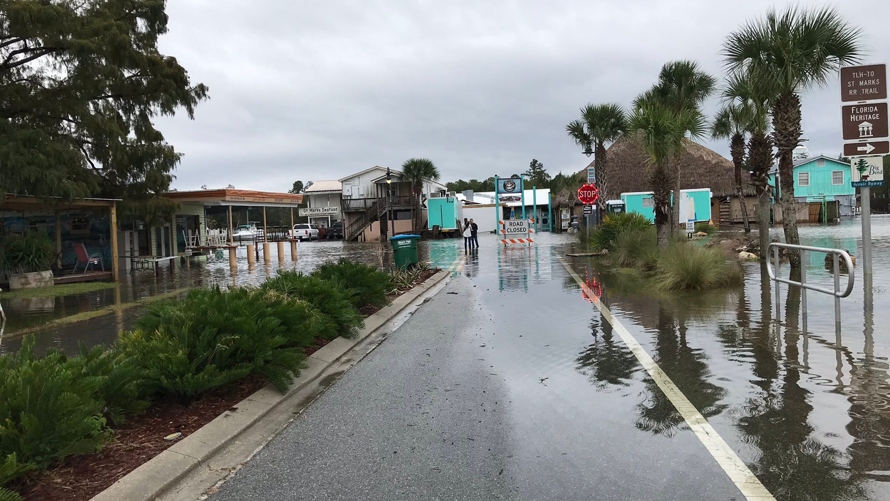
As dawn neared, reports began coming in of storm surge topping streets in Apalachicola and along the North Florida coast.
Much of the overnight storm activity occurred far to the east of Nestor's center with thousands of power outages and reports of roofs peeled from homes and a school in the Tampa Bay area, which remains under a tornado watch.
A tornado, one of many reported, touched down in Seminole and tore through a mobile home park, causing damage to multiple homes.
The storm is expected to move inland Saturday, shedding its tropical characteristics as heads across South Georgia and the Carolinas, according to the National Hurricane Center in Miami.
The storm is expected to move quickly out of the Big Bend and race offshore into the Atlantic Ocean by Sunday night.
Ryan Truchelut contributed to the reporting of this story.
Read or Share this story: https://www.tallahassee.com/story/news/2019/10/19/tropical-storm-nestor-live-updates-tracker-florida-tallahassee/4027718002/
2019-10-19 10:19:00Z
https://www.tallahassee.com/story/news/2019/10/19/tropical-storm-nestor-live-updates-tracker-florida-tallahassee/4027718002/
Read Next >>>>
Bagikan Berita Ini


0 Response to "Tropical Storm Nestor moves through Florida: What we know Saturday - Tallahassee Democrat"
Post a Comment